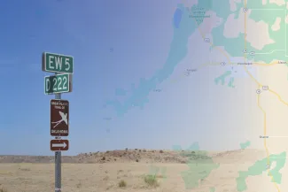
Find your next outdoor travel adventure on the Great Plains Trail of Oklahoma! The trail's 13 highway-based driving loops link area wildlife watching destinations and direct outdoor adventurers to 300 miles of scenic routes that showcase western Oklahoma's natural beauty. Destinations and scenic routes have long been marked with scissor-tailed flycatcher road signs, but travelers can now plan excursions with the Great Plains Trail digital story map, and track their adventures in real time with the Field Maps app (for Apple and Android devices).
The latest story map features each of the trail's 75 public and private-owned destinations, but also helps travelers plan a day of exploration or bird watching. Detailed directions help place wildlife watchers at key locations off the beaten trail at key times. Amenities like guest houses, local motels and RV parks are also identified in the story map.
The Great Plains Trail of Oklahoma is a partnership of the Oklahoma Wildlife and Prairie Heritage Alliance and Oklahoma Department of Wildlife Conservation that connects people with nature by showcasing western Oklahoma's diverse wildlife watching opportunities. Learn more about the Great Plains Trail of Oklahoma and download wildlife checklists for each loop at owpha.org.