
Page 212 - The Freshwater Mussels of Oklahoma
P. 212
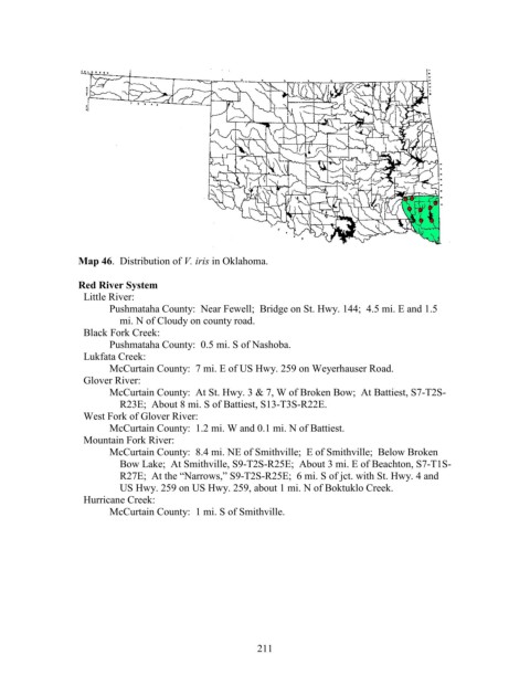
Map 46.  Distribution of V. iris in Oklahoma.

                   Red River System
                     Little River:
                          Pushmataha County:  Near Fewell;  Bridge on St. Hwy. 144;  4.5 mi. E and 1.5
                              mi. N of Cloudy on county road.
                     Black Fork Creek:
                          Pushmataha County:  0.5 mi. S of Nashoba.
                     Lukfata Creek:
                          McCurtain County:  7 mi. E of US Hwy. 259 on Weyerhauser Road.
                     Glover River:
                          McCurtain County:  At St. Hwy. 3 & 7, W of Broken Bow;  At Battiest, S7-T2S-
                              R23E;  About 8 mi. S of Battiest, S13-T3S-R22E.
                     West Fork of Glover River:
                          McCurtain County:  1.2 mi. W and 0.1 mi. N of Battiest.
                     Mountain Fork River:
                          McCurtain County:  8.4 mi. NE of Smithville;  E of Smithville;  Below Broken
                              Bow Lake;  At Smithville, S9-T2S-R25E;  About 3 mi. E of Beachton, S7-T1S-
                              R27E;  At the “Narrows,” S9-T2S-R25E;  6 mi. S of jct. with St. Hwy. 4 and
                              US Hwy. 259 on US Hwy. 259, about 1 mi. N of Boktuklo Creek.
                     Hurricane Creek:
                          McCurtain County:  1 mi. S of Smithville.


                                                            211