
Page 159 - The Freshwater Mussels of Oklahoma
P. 159
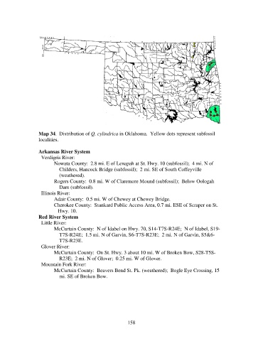
Map 34.  Distribution of Q. cylindrica in Oklahoma.  Yellow dots represent subfossil
                   localities.

                   Arkansas River System
                     Verdigris River:
                          Nowata County:  2.8 mi. E of Lenapah at St. Hwy. 10 (subfossil);  4 mi. N of
                              Childers, Hancock Bridge (subfossil);  2 mi. SE of South Coffeyville
                              (weathered).
                          Rogers County:  0.8 mi. W of Claremore Mound (subfossil);  Below Oologah
                              Dam (subfossil).
                     Illinois River:
                          Adair County:  0.5 mi. W of Chewey at Chewey Bridge.
                          Cherokee County:  Stunkard Public Access Area, 0.7 mi. ESE of Scraper on St.
                             Hwy. 10.
                   Red River System
                     Little River:
                          McCurtain County:  N of Idabel on Hwy. 70, S14-T7S-R24E;  N of Idabel, S19-
                              T7S-R24E;  1.5 mi. N of Garvin, S6-T7S-R23E;  2 mi. N of Garvin, S5&6-
                              T7S-R23E.
                     Glover River:
                          McCurtain County:  On St. Hwy. 3 about 10 mi. W of Broken Bow, S28-T5S-
                              R23E;  2 mi. N of Glover;  0.25 mi. W of Glover.
                     Mountain Fork River:
                          McCurtain County:  Beavers Bend St. Pk. (weathered);  Bogle Eye Crossing, 15
                              mi. SE of Broken Bow.


                                                            158