
Page 87 - The Freshwater Mussels of Oklahoma
P. 87
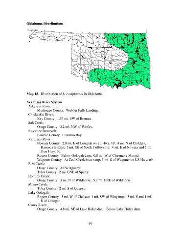
Oklahoma Distribution:


                   Map 18.  Distribution of L. complanata in Oklahoma.

                   Arkansas River System
                     Arkansas River:
                          Muskogee County:  Webber Falls Landing.
                     Chickaskia River:
                          Kay County:  1.53 mi. SW of Braman.
                     Salt Creek:
                          Osage County:  2.2 mi. NW of Fairfax.
                     Keystone Reservoir:
                          Pawnee County:  Cowskin Bay.
                     Verdigris River:
                          Nowata County:  2.8 mi. E of Lenapah on St. Hwy. 10;  4 mi. N of Childers,
                              Hancock Bridge;  2 mi. SE of South Coffeyville;  4 mi. E of Nowata and 1 mi.
                              S on Hwy. 60.
                          Rogers County:  Below Oologah dam;  0.8 mi. W of Claremore Mound.
                          Wagoner County:  At Coal Creek boat ramp, 5 mi. S of Wagoner on US Hwy. 69.
                     Bird Creek:
                          Osage County:  At Nelagoney.
                          Tulsa County:  2 mi. ENE of Sperry.
                     Hominy Creek:
                          Osage County:  3 mi. N of Wildhorse;  5.7 mi. ENE of Wildhorse.
                     Mingo Creek:
                          Tulsa County:  2 mi. S of Owasso.
                     Lake Oologah:
                          Rogers County:  5 mi. W of Chelsea;  1 mi. SW of Winganon;  5 mi. E and 1 mi.
                              N of Oologah.
                     Caney River:
                          Osage County:  4.8 mi. SE of Lake Hulah dam;  Below Lake Hulah dam.


                                                             86