
Page 91 - The Freshwater Mussels of Oklahoma
P. 91
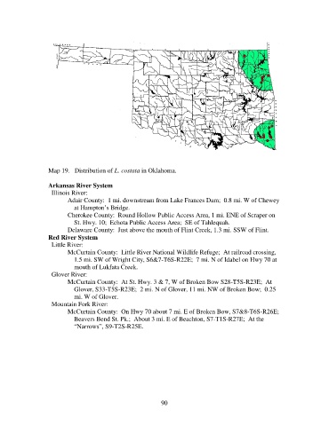
Map 19.   Distribution of L. costata in Oklahoma.

                   Arkansas River System
                     Illinois River:
                          Adair County:  1 mi. downstream from Lake Frances Dam;  0.8 mi. W of Chewey
                              at Hampton’s Bridge.
                          Cherokee County:  Round Hollow Public Access Area, 1 mi. ENE of Scraper on
                              St. Hwy. 10;  Echota Public Access Area;  SE of Tahlequah.
                          Delaware County:  Just above the mouth of Flint Creek, 1.3 mi. SSW of Flint.
                   Red River System
                     Little River:
                          McCurtain County:  Little River National Wildlife Refuge;  At railroad crossing,
                              1.5 mi. SW of Wright City, S6&7-T6S-R22E;  7 mi. N of Idabel on Hwy 70 at
                              mouth of Lukfata Creek.
                     Glover River:
                          McCurtain County:  At St. Hwy. 3 & 7, W of Broken Bow S28-T5S-R23E;  At
                              Glover, S33-T5S-R23E;  2 mi. N of Glover, 11 mi. NW of Broken Bow;  0.25
                              mi. W of Glover.
                     Mountain Fork River:
                          McCurtain County:  On Hwy 70 about 7 mi. E of Broken Bow, S7&8-T6S-R26E;
                              Beavers Bend St. Pk.;  About 3 mi. E of Beachton, S7-T1S-R27E;  At the
                              “Narrows”, S9-T2S-R25E.


                                                             90