
Page 24 - Interp Book
P. 24
Statewide Vegetation Summary
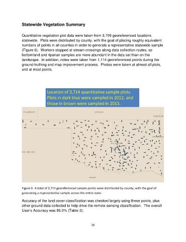
Quantitative vegetation plot data were taken from 3,709 georeferenced locations
statewide. Plots were distributed by county, with the goal of placing roughly equivalent
numbers of points in all counties in order to generate a representative statewide sample
(Figure 6). Workers stopped at stream crossings along data collection routes, so
bottomland and riparian samples are more abundant in the data set than on the
landscape. In addition, notes were taken from 1,114 georeferenced points during the
ground-truthing and map improvement process. Photos were taken at almost all plots,
and at most points.
Figure 6. A total of 3,714 georeferenced sample points were distributed by county, with the goal of
generating a representative sample across the entire state.
Accuracy of the land cover classification was checked largely using these points, plus
other ground data collected to help drive the remote sensing classification. The overall
User’s Accuracy was 85.0% (Table 3).
16