
Page 23 - Interp Book
P. 23
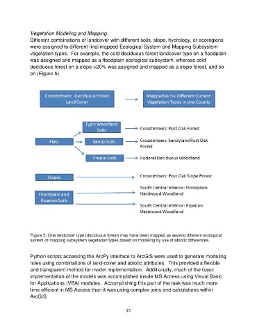
Vegetation Modeling and Mapping.
               Different combinations of landcover with different soils, slope, hydrology, or ecoregions
               were assigned to different final mapped Ecological System and Mapping Subsystem
               vegetation types.  For example, the cold deciduous forest landcover type on a floodplain
               was assigned and mapped as a floodplain ecological subsystem, whereas cold
               deciduous forest on a slope >20% was assigned and mapped as a slope forest, and so
               on (Figure 5).


               Figure 5. One landcover type (deciduous forest) may have been mapped as several different ecological
               system or mapping subsystem vegetation types based on modeling by use of abiotic differences.


               Python scripts accessing the ArcPy interface to ArcGIS were used to generate modeling
               rules using combinations of land-cover and abiotic attributes.  This provided a flexible
               and transparent method for model implementation.  Additionally, much of the basic
               implementation of the models was accomplished inside MS Access using Visual Basic
               for Applications (VBA) modules.  Accomplishing this part of the task was much more
               time efficient in MS Access than it was using complex joins and calculations within
               ArcGIS.


                                                             15