Contacts
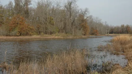
Eufaula WMA covers 48,614 acres in Latimer, McIntosh, Pittsburg and Okmulgee counties in east-central Oklahoma. Eufaula WMA is comprised mainly of flood plain and river bottoms with some upland components. The majority of the area is located on the upper reaches of river and creek arms of Eufaula lake. Mixed upland hardwood timber and openings of grass, brush and old fields dominate the upland sites. Bottom lands range from bottom land hardwood species, such as pin oaks, to dense river bottoms of willow and cottonwood. The WMA is host to a number of natural wetland areas and sloughs as well as about 780 acres of wetland units. Located on lands adjacent to Eufaula lake, 3 major rivers flow through portions of the area. These include the Deep Fork river, North Canadian river and South Canadian river. The average annual precipitation for the area is about 42 inches.
Eufaula WMA – Deep Fork Arm
Western portion, north side – From Henryetta: 2 miles north on U.S. Hwy 75, 3.1 miles east on U.S. Hwy 266, 0.4 miles south on Arbeka Rd, ½ mile east to a small access road to the south.
Western portion, south side – From Henryetta: 2 miles north on U.S. Hwy 75, 3.1 miles east on U.S. Hwy 266, 1.9 miles south on Arbeka Rd, 1½ miles east to a small access road to the north.
Wetland Development Unit – From Henryetta: 2 miles north on U.S. Hwy 75, 4 miles east on U.S. Hwy 266, ¾ mile south on N4000 (Bartlett Rd).
Northern portion – From Checotah: 15 miles west on U.S. Hwy 266, 1 mile west of the Hitchita turn off, south on access road into area. Continuing 1.7 miles west on U.S. Hwy 266, immediately upon crossing the Grave Creek bridge, there is an access on the north side of the highway. Continuing 2¼ miles west on U.S. Hwy 266, at the Okmulgee/McIntosh county line, turn south on N4040 into the area. Continuing 1 mile west on U.S. Hwy 266, turn south on N4030 and travel past Hoffman, into the area.
Southern portion – From U.S. Interstate 40: Exit 247 (Tiger Mountain Rd), 1.8 miles north to the south side of the area.
Eufaula WMA – Duchess Creek Arm
From Checotah: 5 miles east on U.S. Interstate I-40, exit 270 (Texanna Road), 4.4 miles south on Texanna Rd (N4250) to where the blacktop road begins to turn to the west. Take the road to the left (east side) which will continue south as a county dirt road with an intersection to continue south or turn east. From that intersection, continue south to boat ramp. Or, from that intersection, turn east and find WMA access points by turning south in one mile (N4260), two miles (N4270) and three miles (N4280).
Eufaula WMA – Gaines Creek Arm
From Hartshorne: 4 miles north on N4200.
From Haileyville: 1½ miles north on Dow Lake Rd.
Eufaula WMA – Mill Creek Arm
North portion – From Eufaula: 8.4 miles west on State Hwy 9 (past Vivian), 1.6 miles south on N4090 until road turns west, ½ mile west on E1215, 1 mile south on N4085.
South portion (west side) – From Eufaula: 6 miles west on State Hwy 9 to Stidham turnoff, 3 miles south on N4110 to 4-way intersection, 2.7 miles west on E1220 (road veers south and becomes N4100)) to the T intersection, 1.5 miles west on E1240, 1 mile north on N4085.
South portion (east side) – From Eufaula: 6 miles west on State Hwy 9 to Stidham turnoff, 3 miles south on N4110 to 4-way intersection, 2.7 miles west on E1220 (road veers south and becomes N4100)) to the T intersection, 1 mile east on E1240, ¾ mile north on N4110.
Eufaula WMA – North Canadian Arm
North portion - From Checotah: 11 miles west on U.S. Interstate 40, exit 255 (Pierce Rd), 1.2 miles south to Pierce, 2 miles east on E1090, ½ mile south on N4120 into WMA.
Frisbee Ramp (No Name Creek) - From Checotah: 7 miles west on U.S. Interstate 40, exit 259 (Lake Eufaula Rd), 3.7 miles south on Lake Eufaula Rd., boat ramp on east side of the highway.
“Mason Bottoms” portion – From Stidham: ½ mile north past the school on N4110 to four-way stop, 1 mile west on E1130, 1 mile north on N4100 ½ mile west on E1120.
“Mason Bottoms” portion (south side) – From Stidham: ½ mile north past the school on N4110 to four-way stop, 2.8 miles west on E1130, access is on the right (north side).
“Limbo” portion – From Stidham: ½ mile north past the school on N4110 to four-way stop, 4 miles west on E1130, ½ mile north on N4070, 1 mile west on E1125, ½ mile north on N4060 to the T in the road, 1 mile east on E1120.
Eufaula WMA – South Canadian Arm
East end – From Eufaula: 9 miles south on U.S. Hwy 69 to Canadian exit, ½ mile west on State Hwy 113 through Canadian. After crossing the railroad tracks, continue straight on Johnson St (not State Hwy 113), 1/3 mile to T intersection and turn right on to D4135, 1.5 miles north to next intersection. For the west access, turn left (west) across the cattle guard, 1/3 mile west on D1255, when road turns south again turn off and head north to the WMA. For the east access, turn right (east) at the previous intersection onto D1255, 0.6 miles to a dim county road to the north by an old wire corral. Follow the dim road past the corral north to the WMA.
West end – From Indianola: Take 6th Street (E1270) north out of town (will turn back west). This road provides access to the WMA in several places on the right (to west and north) side, immediately at the edge of town and continuing for approximately 1.5 miles to the old sod farm.
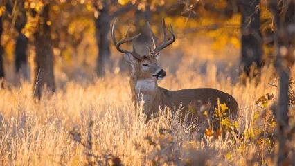
- Deer: White-tailed deer are found throughout the WMA in varying concentrations.
- Turkey: Rio Grande and Eastern turkeys are present, but not abundant and only in a few localized areas.
- Rabbit: Both cottontail and swamp rabbits are found but cottontails are more common.
- Furbearers: Coyote, bobcat, otter, raccoon, and other furbearers are available.
- Dove: Dove can occasionally be found on the agricultural fields.
- Waterfowl: Goose numbers are typically very low. Duck hunting is usually good depending on winter water levels. Duck hunting opportunities are typically concentrated on the river arms adjacent to the lake.
- Squirrel: Both Fox and Gray squirrels are present in good numbers.
- Migratory Nongame Birds: Many shorebirds and other water birds can be seen migrating through in the spring and fall, taking advantage of the lake shore and other wetland areas.
- Bald Eagle: Lake Eufaula hosts resident bald eagles, including multiple nesting sites. Eagles may be observed around the lake year round.
Approximately 1,000 acres are farmed throughout the WMA through lease agreements. Crops grown vary from year to year and from field to field, but include corn, soybeans, milo and wheat.
A number of Corp of Engineers parks are located around the lake, providing camping and boat launch facilities. For information, contact the Eufaula Corps of Engineers project office at (918) 484-5135. There are also state parks and municipal facilities, hotels/motels and restaurants within easy driving distance of the WMA. Further local information can be obtained though the Checotah Chamber of Commerce at (918) 473-2070, the Eufaula Chamber of Commerce at (918) 689-2791, the Henryetta Chamber of Commerce at (918) 652-3331 and the Lake Eufaula Association at (918) 689-7751.
Fishing opportunities abound on the WMA and vicinity. Many of the WMA access roads offer access to Eufaula lake and associated rivers and larger creeks. Most sought species include catfish (channel, blue and flathead), largemouth bass, white bass (locally referred to as "sand bass") and crappie.
All shotgun hunting is restricted to federally approved nontoxic shot on both Mill Creek and Deep Fork WDU portions.
Same As Statewide Seasons
Seasons w/ Special Restrictions
- Quail, Snipe, Woodcock, Rabbit, Squirrel, Pursuit with Hounds for Furbearers, Predator/Furbearer Calling
Closed during the first nine days of deer gun season.
- Bear Archery, Bear Muzzleloader
Open only in portions of McIntosh and Pittsburg counties that are east of U.S. Highway 69 and south of Interstate 40.
- Waterfowl
Same as statewide, except hunting hours for waterfowl close at 1 p.m. daily on the WDU portions.
No camping allowed.
Controlled Hunts: Yet More Ways to Up Your Odds
Additional features continue to be added to the Wildlife Department’s controlled hunts program.
Cackling Geese Tracked in Central Flyway Study
Researchers are tracking cackling geese wintering in a five-state study area to learn more about their movements and habitat preferences.
Study Focused on Bats and Disease-causing Fungus
Bat surveys were conducted to learn more about Oklahoma’s bat communities and hundreds of bats were swabbed for the fungus that causes white-nose syndrome.


